Shaded Fuel Breaks
Here are some shaded fuel break projects of the Tuolumne Fire Safe Council. The information is taken from the draft Community Wildfire Protection Plan which is currently being updated. The updated plan will be posted under Resources when completed.
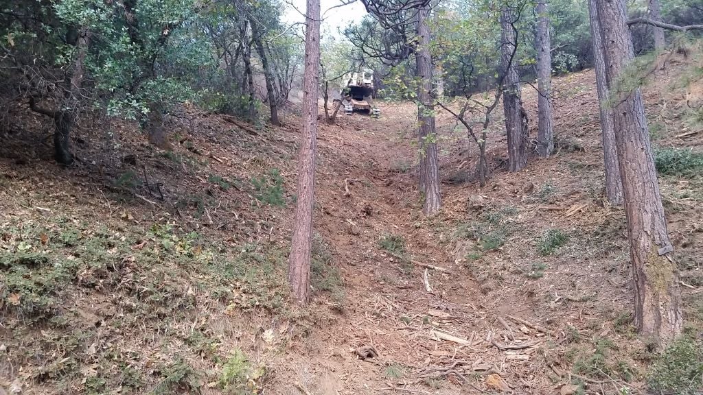
Middle Big Hill Shaded Fuel Break
The shaded fuel break is located along Big Hill Road between Old Oak Ranch Road and the Sierra Glen Apple Ranch. The fuel break connects to the Upper Montgomery Road Fuel Break and the West Ridge Fuel Break that originates at the Sierra Outdoor School and also at the Sierra Glen Apple Ranch.
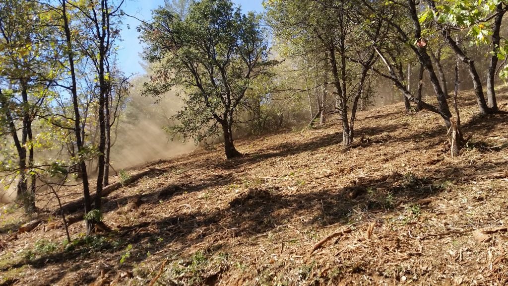
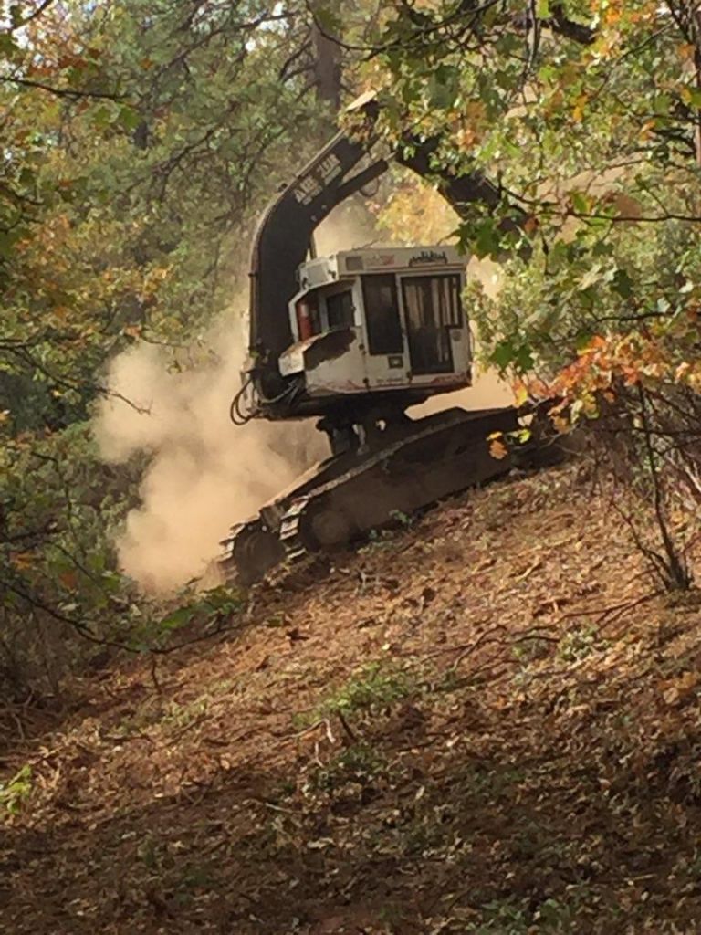
This project removed the buildup of trees and brush encroaching on Big Hill Road, improved sightlines around blind corners, and removed shaded areas of the road that during winter months contribute to ice buildup and hazardous driving conditions. The project covers nearly 79 acres and is 1.57 miles in length.
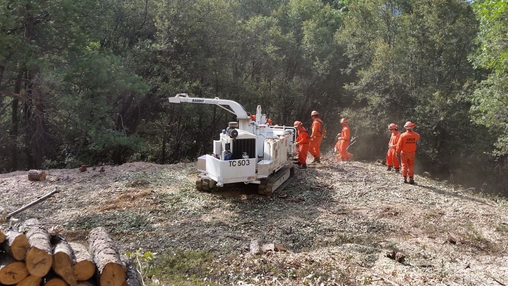
The shaded fuel break construction was funded through a CAL FIRE State Responsibility Area grant.
The shaded fuel break is located in the area of the Oak Fire which began as two separate fires on September 8, 2015, along the north side of Big Hill Road.
Big Hill East and Big Hill West Shaded Fuel Breaks
These fuel breaks connect to the North Bald Mountain Fuel Treatment project and the Sierra Outdoor School to the Cedar Ridge Fuel Treatment projects. The Big Hill East and Big Hill Shaded Fuel Breaks are part of the strategic fire defense system that begins northwest of Columbia near the Blue Mountain Mineral quarry above the Stanislaus River Canyon and New Melones Reservoir and to Mt. Elizabeth north of Twain Harte.
The fuel breaks provide additional resource protection for the Tuolumne Utilities District and PGE water ditches which are the primary water conveyances in Tuolumne County. The reduction of heavy buildup of trees and brush in the area provide improved ingress and egress for the public, education facilities, and public safety first responders.
The Big Hill East Shaded Fuel Break stopped the Oak File in September 2015 that could have been devastating to the area and the nearby Cedar Ridge community.
Mt. Elizabeth South Shaded Fuel Break
This project is located north of Twain Harte just east and south of the Mt. Elizabeth Fire Lookout and south of the Stanislaus River canyon. The Mt. Elizabeth Shaded Fuel Break ties into previously completed fuel treatments that were done along Mt. Elizabeth Drive that is also used as a designated evacuation route for Cedar Ridge. The fuel break is 300 feet wide and covers 150 acres.
Critical infrastructure in the immediate project area include the PGE water ditch system that feeds the Tuolumne Utilities District system in addition to power generation for PGE.
Sierra Glen West Ridge/Big Hill Road Fuels Treatment
This project connects fuel treatments east and south of the Sierra Outdoor School on Old Oak Ranch Road. The approximately 200 feet wide mastication treatment originates at the southern boundary of the Sierra Outdoor School and follows a prominent lateral ridge terminating at Big Hill Road, just east of the Sierra Glen Apple Ranch. The treatment then follows the north side of Big Hill Road to the east, terminating at the Sierra Pines Mobile Home Park.
The treatment along Big Hill Road is approximately 100 to 200 feet wide. Future maintenance goal is to widen the existing treatment area to a minimum of 400 feet wide where possible.
The project was funded under a grant from the United States Forest Service.
Five Mile Regional Learning Center Fuel Reduction
This project provides direct protection to the Sierra Outdoor School located on the former site of the Regional Learning Center on Big Hill Road, east of Columbia. Work reduced the threat from wildfire to infrastructure and provides defensible space for the educational facility which can accommodate 300 school children on a daily basis.
The project was funded under a State of California Proposition 40 grant.
Sierra Outdoor School to Cedar Ridge Fuel Reduction
This project provides the community of Cedar Ridge a secondary evacuation route off the end of Pack Trail Drive where it becomes Forest Road 2N01. 2N01 is a hard gravel surface road that is located on a ridge system between Cedar Ridge and the Sierra Outdoor School off Old Oak Ranch Road. Treated areas represent approximately 100 feet on each side of the road.
The project was funded under a State of California Proposition 40 grant.